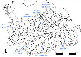
The sites whence the lithic material was collected lie in the catchment of the River Tweed. Most of the sites occur on the cultivated lands adjacent, or near, the rivers as these are most amenable to fieldwalking assays. Nevertheless, some material has been sporadically recovered at higher elevations where the land is given over to rough pasture. Intensive fieldwalking assays have occurred in the Central Tweed, particularly between Kelso and Selkirk, and in the Lower Tweed near Paxton. In addition to this, fieldwalking occurred along the southern banks of the River Tweed in Northumberland as part of the Till-Tweed Project which was undertaken as part of the Aggregates Levy Sustainability Fund assessment of archaeological finds in those regions impacted by quarrying.
The finds recovered through the fieldwalking assays were largely collected without attendant coordinates, insofar that these investigations were undertaken opportunistically as conditions lent themselves to recovering lithics, and as most of this work was conducted by amateurs. In some instances, though, the location of the lithic material was recorded by National Grid Reference coordinates, and on rare occasions, the use of the online application ‘What Three Words’.
Finally, a series of sondages resulted in the recovery of lithic material; some finds have also been encountered during the excavation of later prehistoric and historic sites. The lack of primary deposits containing lithic material, and accompanying radiometric dates, precludes any involved discussion of temporally constrained technological and stylistic characteristics.